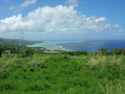
Photo by Jim Hendee
On October 20, 2009, a wide area within Mangaha Marine Conservation Area (MCA), Saipan was investigated to discover a possible suitable site for the installation of a CREWS station. The view above (click on it to see larger), looking south, shows the proximity of Managaha Island (right) to Saipan. For more on the MCA see
this link, and to view satellite data collected for the ICON virtual station, see
this link.
The view below is looking north from Managaha Island toward the spot where the picture above (on Saipan) was taken.
Photo by Derek Manzello.

 Photo by Jim Hendee
